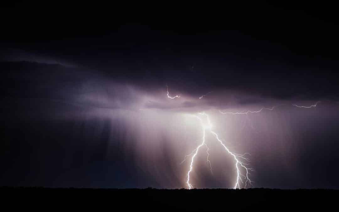

Thunderstorms are common across the BWCA during the paddling season. Photo by Brandon Morgan on Unsplash
Being Prepared For Severe Weather During a Canoe Trip to the Boundary Waters

By Joe Friedrichs
Severe weather that includes baseball-sized hail could descend on the Boundary Waters Canoe Area Wilderness this week.
The National Weather Service (NWS) in Duluth said a series of storms June 12 could bring strong winds, rain, and dangerous conditions to the BWCA and Superior National Forest. The storms, which are expected to begin around 3 p.m., are “capable of very large hail potentially up to 3 inches in diameter, roughly around the size of baseballs. A tornado or two are also possible, especially across north central and northeast Minnesota. The strongest storms will have the potential to produce wind gusts up to 70 mph.”
In a statement sent out this week, the NWS said BWCA “campers should take extra precautions in order to secure campsites and make a plan in case of severe weather. For strong winds, try to keep your tent away from large or decayed trees. For large hail, use your well-tied down canoe or tent for shelter. For lightning, sit on your personal floatation devices or sleeping pads to minimize your risk and avoid putting your tent on top of exposed tree roots.”
Areas included in the weather alert include the entire BWCA, and a vast area of northern Minnesota that stretches from Ely to Grand Marais and down toward Duluth. Most of Quetico Provincial Park is likely to be impacted by the storm as well, including the Cache Bay Ranger Station on Saganaga Lake near the end of the Gunflint Trail.
A difficult question some visitors to the BWCA face when a weather alert like this is issued by the NWS is how much it should impact the trip. After all, the weather service has the expectation of precipitation at 50 to 60 percent, meaning there’s a chance the storm will miss the BWCA entirely, or be less intense than predicted. At the very least, it makes sense to plan for the worst. Don’t get stuck paddling across big water with a forecast like this. Be ready for the storm rather than react to it. The Paddle and Portage team has been caught in some extreme weather in the BWCA, and we typically spend our time under the rain tarp in an afternoon storm similar to the one predicted for June 12. It’s also understandable that some groups opt to leave the wilderness a day early, or dedicate a day to camp with a forecast such as this, particularly when children are on the trip.
The Boundary Waters is a place where severe weather can impact people in life-threatening ways, as Minnesota author Cary Griffith explains in his book “Gunflint Falling” about the 1999 Blowdown storm.
Support this type of news and information from and about the Boundary Waters by becoming a member of Paddle and Portage.
Other Recent Articles

Bear Attack In Wabakimi and Drowning in Quetico Illustrate Risks of Canoe-Country Travel
Black bears are common across the canoe-country wilderness. Photo by Kevin "The Kman" KramerAn Indiana man was taken to hospital after a bear attack at a fly-in resort in Wabakimi Provincial Park June 12, suffering non-life threatening injuries. Emergency crews were...

Valentinis’ Move Symbolic of Generational Shift on Gunflint Trail
Michael and Sally Valentini at their home on the Seagull River at the end of the Gunflint Trail. Photo by Joe Friedrichs“While something may come to an ending on the surface of time, its presence, meaning and effect continue to be held and integrated into the eternal....

Curtain Falls in the BWCA Created ‘The Most Complex Operation’ In History of Rescue Squad
Paddle and Portage Bonus Audio · Curtain Falls Summary Debrief With St Louis County Rescue SquadPaddle and Portage met with members of the St. Louis County Rescue Squad at their headquarters on the outskirts of Duluth to review the recent search and recovery operation...